

Geotech
20 products found
Geotech products
GEOTECH - OKO‐3 NAUTILUS FOR UNDERWATER MONITORING
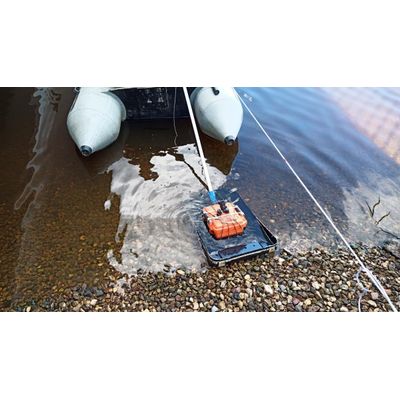
The new development is the first underwater GPR of the OKO-3 series. The device received its unique properties due to the built-in underwater antenna AB-700M3P. Equipped with a central frequency of 700 MHz, it provides a wide range of possibilities for examining the condition of the underwater part of concrete structures. This development allows to immerse the GPR to a depth of 10 meters and sound concrete up to 2.5 meters.
Features:
– Underwater shielded antenna unit with a center frequency of 700 MHz;
– Immersion depth in water up to 10 meters;
– Sounding depth of concrete up to 2 meters;
– Topographic referencing via differential GPS;
– Data export to GIS.
Applications:
– Search and localization of various defects in the underwater and surface parts of reinforced concrete structures;
– Determination of reinforcement, reinforcement pitch, and cover depth;
– Localization of waterlogged areas behind concrete;
– Detection of voids behind lining space.
Geophysical Equipments
Model OKO-3 - GPR with a Control Unit
The OKO-3 GPR is a portable lightweight low-prices system designed for non-destructive environmental monitoring. The OKO-3 GPR includes the control unit and antennas. All antennas are interchangeable and meet the needs of a broad range of applications.
GEOTECH - Model OKO-3 - ALL-IN-ONE GPR SYSTEM
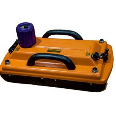
The All‐in‐one GPR system is a GPR solution that combines the antenna and the control unit into one enclosure. This new generation of GPR offers a quick and efficient way to prepare a GPR for inspection. The All‐in‐one GPR system is connected with a laptop via Ethernet cable. Its low‐cost GPR solutions are delivered with all necessary accessories, such as an odometer, a power supply unit, a charger, and cables. Our uniquely designed collapsible cart (for some models) makes detection easy and convenient.
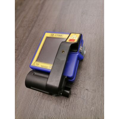
GEOTECH - Model OKO-3 - CONSTRUCTION SCAN 1700
Construction Scan 1700 3D is a portable all-in one GPR solution designed for automated localizing defects in a wide variety of wood,brick and reinforcement concrete structures, at depth of 1 m.
Application: Detection and location of different defects in reinforced concrete; Cells, cavities; Foreign inclusions ; Cracks, layering; Determination of reinforcement specifications ;Size; Occurrence depth; Degree of corrosion; Detection of buried wiring, cables and communications lines; Detection of plastic and metal pipelines etc.
Construction Scan 1700 includes a control processing unit, LCD display, the antenna unit AB-1700 and a power supply unit in one enclosure. The control processing unit provides processing, displaying and saving of the scanning results. CS-1700 accumulates information in the internal 2 GB Flash memory card and transfers it to the PC via the USB interface. There is a special marking rug with a bar code for precision 3D scanning of objects.
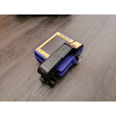
GEOTECH - Model OKO-3 - CONSTRUCTION SCAN 2500
Construction Scan 2500 is a portable all-in one GPR solution designed for automated localizing defects in a wide variety of wood,brick and reinforcement concrete structures, at depth of 0,6 m.
Application: Detection and location of different defects in reinforced concrete; Cells, cavities; Foreign inclusions; Cracks, layering; Determination of reinforcement specifications ;Size; Occurrence depth; Degree of corrosion; Detection of buried wiring, cables and communications lines; Detection of plastic and metal pipelines etc.
Construction Scan 2500 includes a control processing unit, LCD display, the antenna unit AB-2500 and a power supply unit in one enclosure. The control processing unit provides processing, displaying and saving of the scanning results. CS-2500 accumulates information in the internal 2 GB Flash memory card and transfers it to the PC via the USB interface. There is a special marking rug with a bar code for precision 3D scanning of objects.
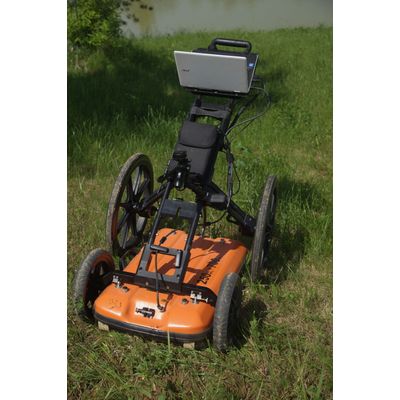
GEOTECH - Model OKO-3 - CartScan
This GPR system is designed to locate the depth and position of utilities such as pipes, cables, reservoirs and drainage systems in a variety of soils at different depths. "CartScan" software allows its user to display all information on Google Earth.
Features: Dual-frequency antenna (250 and 700 MHz) for deep and shallow survey in single scan; Two odometers embedded in the wheels for more accurate marking; Real time data collection; Enhanced 3D capabilities; Automatic GPS integration; Google Earth Integration.
CartScan is a turnkey GPR solution for detection of buried utilities. The systems consists of dual-frequency antenna (250 and 700 MHz), GPS-receiver, and two odometers built into the wheels of trolley. By using data collected from the odometers and GPS-receiver simultaneously, the user can locate and mark utilities accurately and quickly.
An antenna with dual frequencies of 250 and 700 MHz provides GPR data at depths of 5 and 8 meters simultaneously or separately.
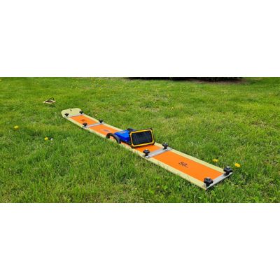
GEOTECH - Model OKO-3 - GPR WITH THE DEEP ANTENNA UNIT TRITON-M
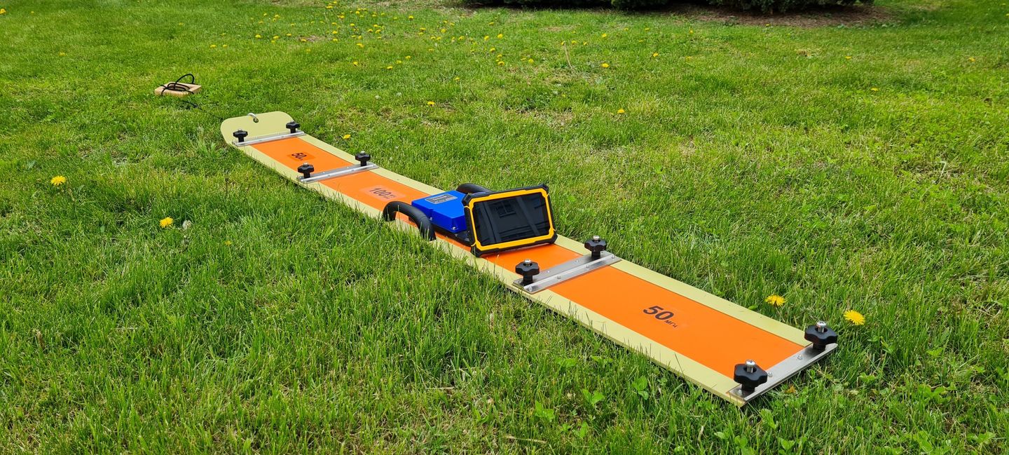
The new radar with the unshielded unit Triton-M has a central frequency of 50/100 MHz and is intended for geophysical surveys under linear objects and engineering structures, as well as for geological work requiring an increase in depth. The main purpose is to carry out GPR surveys on rough terrain and in difficult operating conditions.
The major advantages of Triton-M are its small dimensions due to the collapsible design, as well as ease of assembly. The antenna unit consists of 2 sub-segments that fit into the convenient transport case included in the kit. These segments make it possible to change the central frequency of sounding between 50 MHz and 100 MHz.
Features:
Unshielded antenna unit;
Possibility of varying the central frequency of sounding — 50/100MHz;
Maximum sounding depth up to 14/18 m;
Depth resolution from 0.5 to 1 m;
Power consumption — 3.6 W;
Collapsible 2-piece construction;
Wireless control via WI-Fi from Android / Windows devices.
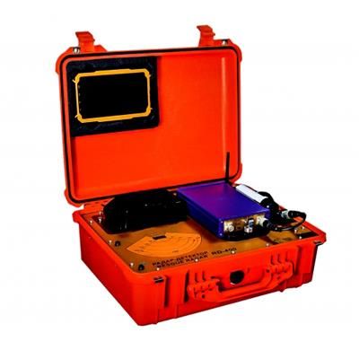
GEOTECH - Model OKO-3 - RADAR DETECTOR RD-400
Radar Detector RD-400
To Help Locate Survivors Buried Under Rubble and Debris.
The RD-400 is portable radio detection system designed to locate survivors buried under rubble or debris by either movement or breathing.
The RD-400 is based on GPR technology, which allows it to accurately pinpoint the location of a survivor and determine the distance to him or her. It is utilized for emergency teams during search and rescue operations after a catastrophic attack or a natural disaster.
The device is very simple to operate. It turns on with a single press of a button, sending GPR signals into the wreckage, quickly fixing on any movement or breathing. An accompanying Tablet PC displays the distance to the survivor using a red line for movement and a blue line for breathing.
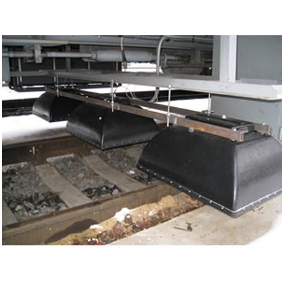
GEOTECH - Model OKO - MULTICHANNEL GPR FOR RAILWAY INSPECTION
The multichannel GPR complex was designed for monitoring the state of the ballast section and upper layer of the natural bed.
APPLICATION: Determination of the railway embankment width and structure content; Allocation of subsidence in the ballast and natural bed layers; Determination of the natural bed; Mapping underground pipelines crossing railway embankment; Control of conformation of railway embankment structure to the project documentation.
FEATURES: high speed multi-channel control unit; number of channels: up to six (up to 6 profiles simultaneously); antennas frequency: from 150MHz up to 2500MHz; maximum survey speed: up to 120 km/h; detection depth: up to 8m; creating 3D model of ballast; GPS integration; automatic data processing.
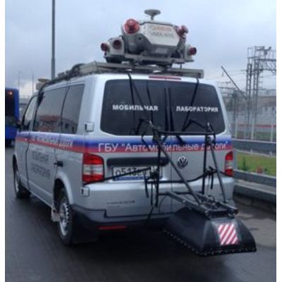
GEOTECH - Model OKO-3 - GPR FOR ROAD INVESTIGATION
The OKO-3 GPR Road Set uses special horn antennas (400-2500MHz) suspended above ground level and fixed to the vehicle by car suspension. The complex offers the users the single-channel and multi-channel solutions for high resolution survey up to 80 km per hour.
Geotech has a big experience of geophysical research on highway and collaborates with the leading Russian Road Companies.
Application: Engineering geophysical surveys for highways and overbridges construction; Determining thickness of road pavement structural layers; Detection of subsidence; Detection of non solid and watered zones; Study of engineering geological conditions of the zones liable to deformation; Study of dangerous engineering geological processes: Landslides, floating earth, karstic phenomena; Checking highway pavement structure compliance with project documentation.
The Horn antennas (with central frequency from 400 to 2500 MHz) are designed for the detailed examination of pavement layer thickness.