

g-Viewer™ - Geophysical Data Visualization Software
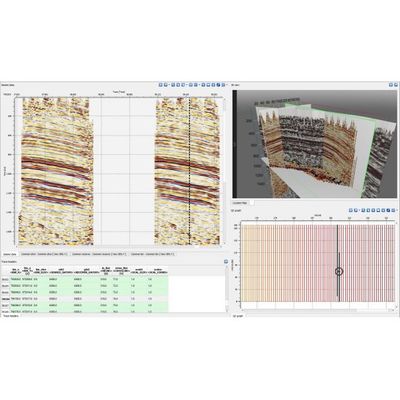
g-Viewer™ software designed to visualize multiple files in different formats. Current version includes: Load and review Seg-Y files of any size. Load multiple Seg-Y files – 2D and 3D. Selection of active dataset from location map. Graphical representation of trace header(s) above seismogram view. Cross-plot any 3 trace headers (horizontal-vertical-color ). Load of geometry from trace headers. Editing trace header scheme per each dataset. Selection and representation of CS/CR/CMP gathers picked from location map. Selection and representation of active trace from seismogram/location map. Editing text and bin headers. And the AUTO-UPDATE, so you could get new version whenever its available. More features to come soon are Seg-D, Las, Shape, ASCII, SU and other formats.