


- Home
- Companies
- Hortus s.r.l.
- Products
- Hortus - Model HMS-Geo Series - ...
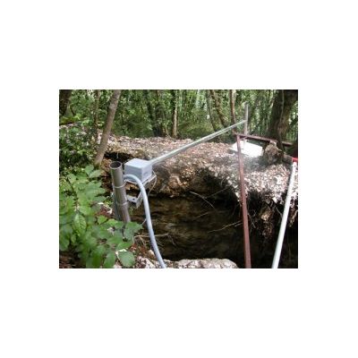
Hortus - Model HMS-Geo Series -Geotechnical Stations
System to control slope instability phenomena, able to use large sensors set (of different typology and manufacture). Station made to work in unmanned severe weather conditions, with low power consumption characterized by: modular and high performing data acquisition system (Campbell Scientific and Datataker datalogger), able to connect distributed Wireless Sensor Network, equipment and GPRS data transmission reliability, quality and accuracy of geotechnical and weather sensors.
Also available with dual data transmission system GPRS, Ethernet and/or UHF to ensure the highest system reliability
HMS-GEOwsn
- advanced solution to manage Wireless Sensor Network
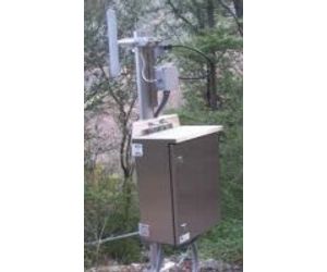
- Stainless steel IP66 enclosure, with welded stainless steel brackets for mounting to pole
- Data acquisition system based on Campbell Scientific CR1000 with enhanced software programming and automatic GPRS transfer of data
- SIERRA Wireless Xtend modem GSM/EDGE with GSM antenna
- 60W photovoltaic power supply kit with stainless steel brackets for mounting to pole and 40Ah GEL battery
- Multiplexer + 24Vdc voltage regulator + CV120 relay module, to manage sensor supply geotechnical and metereological sensors
- WSN system (spatially distributed autonomous sensors)
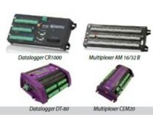
HMS-GEO data acquisition system based on different data-logger:
- Campbell Scientific CR-series
- DataTaker DT-8x series
Is convenient to use multiplexer to increase the number of sensors connected to a data-logger by signal cables, and there are several possible configurations to maximize the type and the number of sensors connected to a single data-logger. Each type of datalogger can support different multiplexer (see table below).
A wireless sensor network (WSN) consists of spatially distributed autonomous sensors to monitor environmental parameters, and to cooperatively pass their data through the network to a gateway node.
The WSN is built of nodes, and each node is connected to one (or sometimes several) sensors. Each sensor network node has typically several parts: a radio transceiver with an internal antenna or connection to an external antenna, a microcontroller, an electronic circuit for interfacing with the sensors and an energy source, usually a battery or an embedded form of energy harvesting.
The topology of the WSNs can vary from a simple star network to an advanced multi-hop wireless mesh network. In HMS-GEO series it’s possible to configure 3 types of WSN system, made by different producers; each has its specific potentials, to be considered on an individual basis.
To monitor the evolution of landslides, or instability of a slope, it’s possible to use different types of automatic sensors, depending on the nature of the phenomenon, and environmental conditions. The geotechnical instrumentation integrated into HMS-GEO series allow to acquire data about the main factors that determine the conditions of instability of the slope on the surface and in depth: inspection of the fracture surface, inspection of the sliding surfaces and deep of groundwater.
The geotechnical sensors proposed below have all the features we consider essential:
- solidity
- reliability
- integration
Some sensors supported by HMS-GEO can be managed in a WSN system.
A lot of accessories are available to customize your HMS-GEO system.
- Enclosure: a large selection for all installation requirements.
- Supply: to ensure correct “energy charge” to the system.
- Stainless steel supports: reliability and durability guaranteed for all types of installation.
- Electrical components: to drive better all the sensors and optimize energy consumption.
- Installation and maintenance: specialized assistance from Assembly to Z.