

WingtraOne - Mapping Drone
WingtraOne’s unique set of features empowers you to minimize your time flying and get more work done, be it another project in the field or analyzing your data at the office.
- Efficient fixed-wing flight : Fly at 16 m/s (36 mph) for up to 59 minutes per flight for large coverage.
- 42 MP camera : WingtraOne can fly higher than drones limited to 20 MP cameras, so you capture more ground and more detail with every picture and a larger area per flight.
- No more GCPs, checkpoints only : With an onboard high-precision PPK GNSS receiver you no longer need to lay out ground control points (GCPs). Use as few as three checkpoints to verify your map quality.
- Lower image overlaps : High quality optics means you can reconstruct your map reliably even with lower overlaps. This means more new ground covered per flight line and maximum coverage per flight.
Whether it’s a highway, an industrial complex or a mine, you can now take on large projects that were previously impossible to map with a drone. And it takes you just a few hours.
Thanks to its VTOL design, WingtraOne can take-off and land almost anywhere—even in confined spaces or on rough terrain. This enables you to collect data where other drones cannot.
Achieve higher resolution and accurate aerial survey results with the Sony 42 MP full-frame and other best-in-class cameras, such as the MicaSense Altum multispectral.
High quality, swappable and durable
- Unwavering aerial image quality : Thanks to its heavy payload capacity, WingtraOne carries the highest quality cameras on the market.
- Easy to swap : Easily change cameras in the field. Get the flexibility of extremely high resolution RGB cameras or leading edge multispectral imagery.
- Protected from landing shock : Thanks to the smooth vertical landing, your high-quality cameras are always protected, even in rough environments, ensuring a longer lifespan.
Discover robust, easy-to-use features for the most demanding mapping projects
- Ready to fly in five minutes : The WingtraOne drone comes with a tablet featuring WingtraPilot, the built-in app for easily managing data acquisition. The intuitive app includes various ways to prepare flight plans as well as monitor and review missions during flight.
- 5 min setup : Take off in less than five minutes, including drone setup, all pre-flight steps and planning of a simple mapping mission.
- Pre-flight checklist : WingtraPilot guarantees full functionality of the drone before the flight by running background checks like battery health, GPS reception and test images.
- Fully autonomous : Automated launch, in-flight data collection and landing without human interaction.
- Pause and resume : Pause the survey mission at any time to make the drone loiter in the air, or trigger return to home (RTH), causing the drone to fly back to its take-off location automatically. From both of these states at any time, you can resume the survey mission, and the drone will start capturing images from where it stopped.
- Manual take-over with in-app controls : Take manual control of the drone at any time during landing. Use the intuitive controls on the tablet to adjust its position mid-air and land safely.
- Real-time monitoring : Displays information like flight location, altitude and mission progress from a range of up to 10 km (6 mi).
- Smart voice : Provides you with comprehensive audio feedback during the mission
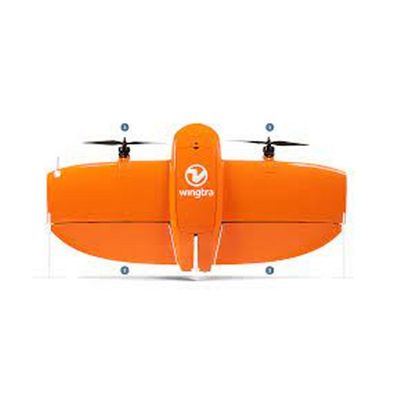
- Drone type :Tailsitter vertical take-off and landing (VTOL)
- Weight :3.7 kg (8.1 lb)
- Max. payload weight :800 g (1.8 lb)
- Wingspan :125 cm (4.1 ft)
- Battery capacity :Two 99 Wh batteries (a pair of batteries required)
- Radio link :Bi-directional 10 km (6 mi) in direct line of sight, keep in mind that obstacles reduce the range
Software and tablet
- Flight planning & mission control software : WingtraPilot
- Tablet supplied : Rugged Samsung Galaxy Tab Active 2, water and dust resistant, MIL-STD-810-certified, pre-installed; interfaces to telemetry module and manual back-up controller
Operations
- Flight speed : 16 m/s (35.8 mph)
- Wind resistance : Up to 8 m/s (19 mph) wind speeds
- 8 m/s (18 mph) wind speed measured on the ground corresponds to approximately 10 m/s (22 mph) surface wind
- Maximum flight time : Up to 59 min
- See Knowledge Base for what flight time to expect in different flying conditions
- Min. space for take-off and landing : 2 m × 2 m (6.6 ft × 6.6 ft)
- Temperature : -10 to +40 °C (14 to 104 °F)
- Max. take-off altitude above sea level : 2500 m (8200 ft)
- With high-altitude propellers it is possible to take off from up to 4800 m (15,700 ft) and fly up to 5000 m (16,400 ft) AMSL
- Weather : IP54, not recommended to fly in fog, rain and snow
- Ground Control Points required : No (with PPK option) Using 3 checkpoints to verify the accuracy is recommended
- Auto-Landing accuracy : < 5 m (< 16 ft)