
- Home
- Companies
- Shenyang Jiazhi Technology Co., Ltd.,
- Products
- GoSLAM - Model RS100 - Mobile ...
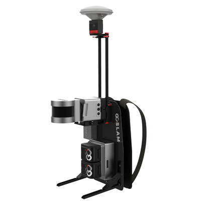
GoSLAM - Model RS100 -Mobile Measurement System
GoSLAM mobile measurement system adopts SLAM technology (Simultaneous localization and Mapping), that is, real-time positioning and mapping technology does not depend on GNSS positioning such as GPS. In the movement of unknown environment such as indoor and outdoor space, self-positioning and incremental 3D mapping are carried out. GoSLAM is committed to providing customers with solutions for mobile 3D laser measurement systems with a better user experience.
Mixed solution, export and use
- Multiple solutions ensure that the data is correct
- High protection, multi-platform
- Long distance, high frequency
Strong performance
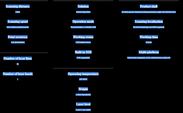
Equipped with a rotating laser probe, 120 meters range, 650,000 points collected per second, relative point accuracy 1cm (with low reflectivity extended range mode)
Hybrid solution technique
RS100 product has a unique hybrid solution technology. This ensures higher accuracy and improves the speed of its own solution. It greatly improves the scanning efficiency to match the post-processing software
Super weather resistance and multi-platform support
RS100 system is extremely weatherable and can operate at -30-60?. It is compatible with backpack, uav, vehicle and other mobile platforms
Color Module
As the true color scheme of GoSLAM point cloud, the color module is plug and play, without complicated operation of additional image import, integrated synchronous collection, the data can be fully automatic color point cloud coloring and panoramic image point cloud linkage.
Real-Time Preview Of Mobile APP
Mobile apps replace traditional touch screens. Browse point cloud data in real time through APP during operation. It supports a variety of browsing interaction and more human-computer interaction content
Supporting post-processing software
GoSLAM Studio Flagship Version software is specially designed and developed for the GoSLAM series of mobile 3D scanners, integrating device application and point cloud processing. It is also compatible with third-party device point cloud processing. The software has eight basic functions: one-click point cloud denoising, point cloud splicing, shadow rendering, coordinate transformation, automatic horizontal plane fitting, automatic point cloud data report generation, forward photography and point cloud encapsulation. GoSLAM adds one-click heap data generation to bulk metering to make it easier to access data.