

- Home
- Companies
- Sharper Shape Inc.
- Services
- Data Collection Services
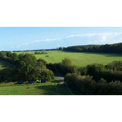
Data Collection Services
LiDAR
Gather large-scale geospatial data to create a detailed 3D point cloud replica of your assets. Map every conductor, pole or tree for granular analysis. What’s more, this will serve as the asset-map for future drone-based automatic detailed inspection.
RGB HD Imagery
Capture high-definition images of your assets from multiple angles to enhance remote component defect inspection. Every image is geotagged and linked to the specific component for easy, rapid remote inspection.
Hyperspectral
Use hyperspectral imaging to collect data from parts of the electromagnetic spectrum invisible to the human eye, enabling insights such as vegetation health and species detection for smarter vegetation management planning.
IR Imagery
Apply infrared thermal imaging for instant hotspot detection, helping you to identify equipment failure risks ahead of time and enhancing preventative asset management programs while improving safety.
20,000+
Distribution poles
captured by automated drones
6m
Structures
inspected in CORE
42,000
Miles
6,000,000 structures inspected in CORE
6.4
petabytes of data
collected and analyzed by CORE software