

INT, Inc.
Version INTViewer -Rapid Geoscience QA/QC
FromINT, Inc.
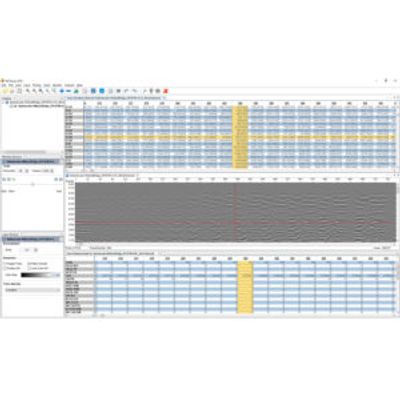
INTViewer is a platform and application that allows you to view your seismic data, check for errors, confirm geospatial integrity, perform light processing, and analyze your dataset. INTViewer is specifically designed to quickly access large datasets—prestack, stack, and 2D—from a laptop in the field to a desktop or remotely via the cloud. As a platform, INTViewer makes it easy to add or implement proprietary features on your own to meet the specific needs of your project, and with a simple Python script, you can automate your analysis. Or you can use INTViewer right out of the box as a complete application to work with your data instantly.
Most popular related searches
seismic
seismic data
seismic analysis
seismic data acquisition
velocity monitoring
process analyzer
automatic analysis
trace monitoring
geoscience
geospatial
- Display the SGY data
- Check SGY metadata (EBCDIC and Binary headers)
- Index the SGY file (Check header mapping/Byte Locations)
- Transpose the indexed XGY file
- Create header maps and crossplots
- Scan through seismic time slices
- Scan through Inline and Crossline slices
- Display a subset of the dataset
- QC seismic frequency and amplitude distribution of inlines, crosslines, and arbitrary lines
- Calculate Average Signal to Noise Ratio
- Extract phase or amplitude attributes from a horizon
- Transparent overlay of fold or velocity attributes on seismic
- Create and scan an edge detection or coherency volume
- Automate some steps with Python
- Display Gathers on new Cross-Section Window
- Display Gathers using Variable Trace spacing
- Velocity measurement
- Signal to Noise Analysis
- FK Analysis
INTViewer lets you compare and analyze relationships between various attribute volumes on the same grid, gather AVO plots, and display 4D analysis along a horizon. And with INTViewer’s ability to QC horizons in one sweeping view, you can identify anomalies quickly.