

EarthSoft, Inc
Visualizing Hydrogeology Software
FromEarthSoft, Inc
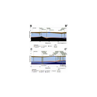
EnviroInsite includes powerful tools for analysis and visualization of subsurface soils and stratigraphy. Detailed soil descriptions and stratigraphic interpretations are stored separately. Contents of detailed soil descriptions can be presented on boring logs, strip logs, 3d boring logs, and drawn onto x-sections. All of the same tools are available for stratigraphic data, but in addition stratigraphic data may be presented by contouring of contact elevations or unit thickness, 3d fence diagrams, and geologic modeling on x-sections.
Most popular related searches
- 3d Fence Diagrams
- 3d Boreholes
- Boreholes on X-Sections
- Strata Modeling on X-Sections
- Contact Elevation Contours
- Strata Thickness Contours
- Customizable Strip Logs