
- Home
- Applications
- namibia
- soil mapping
Show results for
Refine by
Soil Mapping Product Applications Available In Namibia
8 applications found

ByZZ Resistivity Imaging Pty. Ltd. based in Maylands, AUSTRALIA
There are 122,000 earthen dams in the Unites States and Europe, many between 50 and 100 years old; and 24,513 miles of levees throughout the U.S., many are earthen, aging, and under-uninspected. Failure would be catastrophic for downstream populations. ...
ByASTERRA based in Kfar Saba, ISRAEL
VIY3 GPRs allow to have a topography of subterrain structure down to 15 meters. That the good application for underground water exploration, searching for harmful chemical pollutions and underground cavities ...
ByTransient Technologies LLC based in Kyiv, UKRAINE
The DeltaQuad Pro #MAP provides actionable intelligence for agriculture using high quality camera sensors. ...
ByVertical Technologies based in Badhoevedorp, NETHERLANDS
Precision Agriculture; Detect crop diseases before they're visible to the naked eye. Apply fertilizer only when/where necessary. Take hyper-localized, targeted actions on your farm such as knowing exactly how much to water your crops or when to act quick to prevent the spread of ...
ByMetaspectral based in Vancouver, BRITISH COLUMBIA (CANADA)
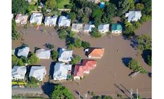
Dynamically model natural channels in rural and urban watersheds, taking into account flooded structures, backwater effects, spatially-distributed and dynamic rainfalls, groundwater interflow and flood inundation. Computed results can be animated in two-dimensions and projected obliquely in Google ...
ByComputational Hydraulics International (CHI) based in Guelph, ONTARIO (CANADA)
Do you need to irrigate? What is the soil moisture? Is the fruit ripe? What is the BWE? Finapp answers these questions in a completely new way. Forget punctual probes, forget satellite observation, only a true technological revolution could change the cards and we did it! Find out ...
ByFinapp S.r.l. based in Montegrotto Terme PD, ITALY
MAP, with its low pH levels, is best used for high-alkaline soils. It is an ideal starter fertilizer because MAP contains less ammonia-nitrogen than DAP, reducing potential seed damage.MAP has been an important phosphate fertilizer for growers around the world for many years. ...
BySichuan Mianzhu Hanwang Inorganic Salt Chemical Industry Co.,Ltd based in Mianzhu, CHINA