
- Home
- Applications
- groundwater investigation
Refine by
Groundwater Investigation Product Applications
8 applications found
Tracer tests serve as detection of flow conjunctions and spreading processes in groundwater as well as the investigation and quantification of reactive transport processes. ...
ByHydroisotop GmbH based in Schweitenkirchen, GERMANY

Identify productive zones at high resolution and predict yield in pilot borings to determine optimal screen placement and inform well ...
ByVista Clara, Inc based in Mukilteo, WASHINGTON (USA)
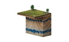
Direct, Non-invasive Detection and Imaging of Groundwater to Depths of up to 500 feet (150 Meters). Surface magnetic resonance (also known as surface NMR, proton magnetic resonance and magnetic resonance sounding) is a powerful ground-based geophysical method used to non-invasively detect, measure and image groundwater. Vista Clara’s GMR and GMR-Flex multi-channel surface NMR instruments work by using the same physics as medical MRI. Surface magnetic resonance measures hydrogen protons in groundwater to ...
ByVista Clara, Inc based in Mukilteo, WASHINGTON (USA)

Characterization of contaminated groundwater requires detailed monitoring to eliminate data gaps, improve predictive numerical models, and track remedial efforts. The Westbay System is a reliable, cost-effective technology for obtaining detailed information, enabling groundwater professionals to carry out comprehensive and defensible contaminant site investigations and long-term ...
ByWestbay Instruments - part of Nova Metrix LLC based in Burnaby, BRITISH COLUMBIA (CANADA)

Geophysical resistivity and IP imaging for geotechnical ...
ByAdvanced Geosciences Inc. (AGI) based in Austin, TEXAS (USA)
Geophysical resistivity and IP imaging for construction site ...
ByAdvanced Geosciences Inc. (AGI) based in Austin, TEXAS (USA)
Bathymetry – freshwater lake/riverbed investigations. Bedrock profiling. Karst investigations and sinkhole mapping. Stratigraphy studies. Water table studies. Sinkhole ...
ByImpulseRadar Sweden AB based in Malå, SWEDEN
Site classification according to EC8 and DIN4149. In order to quantify the design load for buildings due to an earthquake the Eurocode 8 (EC8) and the DIN4149 require the classification of the ground. The dominating or average shear wave velocity in depths down to 30 m is most often used for this classification. Beyond that the standards request certain design features as flexible foundation beams based on the class of the subsoil which are affecting the costs of a building. A seismic survey can often reduce the ...
ByGeotomographie GmbH based in Neuwied, GERMANY