
Gnss Receiver Articles & Analysis
21 articles found
A GPS-Aided INS comprises an inertial measurement unit (IMU) containing three-axis accelerometers, gyroscopes, and a GNSS receiver. After initial orientation and bias estimation, data from the IMU and GNSS receiver get fed through a robust Kalman filter algorithm, in which the unit will begin outputting correct and accurate ...
Global Navigation Satellite System (GNSS) and Satellite Navigation Explained Abstract Global Navigation Satellite System (GNSS) technology is a collection of satellite positioning systems with worldwide coverage. ...

Users can choose a configuration with a camera, a LiDAR model, and a GNSS receiver. The standard configuration is designed for use on drones and other types of sUAS (small, unmanned aircraft systems).After the flight, the raw data must undergo post-processing—thanks to this procedure, a georeferenced point cloud is formed. ...
This compact device is fully customizable to accommodate various applications, offering options such as camera inclusion, LiDAR model selection, and GNSS receiver. It’s commonly utilized for drones and other small, unmanned aircraft systems (sUAS).After data collection by LiDAR payloads like RESEPI, it is crucial to subject the raw data to post-processing before ...
This compact device is fully customizable to accommodate various applications, offering options such as camera inclusion, LiDAR model selection, and GNSS receiver. These configurations are commonly utilized for drones and other small, unmanned aircraft systems (sUAS). ...
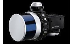
It offers a LiDAR model, camera installation, and GNSS receiver. Thus, the user pays only for what they need. Data collected by RESEPI Payloads are not usable without post-processing. ...
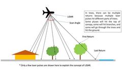
Users can choose configurations that include a camera, LiDAR model, and GNSS receiver. It is most used on drones and small unmanned aircraft systems (sUAS). ...
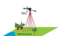
This compact device is fully customizable to accommodate various applications, offering options such as camera inclusion, LiDAR model selection, and GNSS receiver. It is commonly utilized for drones and other small unmanned aircraft systems (sUAS). ...
Users can select a configuration with a camera, LiDAR model, and GNSS receiver. The most common use is on drones and other types of sUAS (small, unmanned aircraft systems). ...
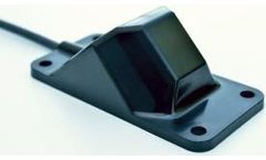
While the positioning accuracy from STL signals is lower than that of traditional GNSS signals, the hybrid approach of utilizing both receivers is an added benefit that complements GPS/GNSS outages. ...
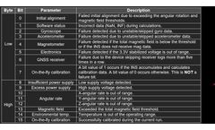
LED Status The color and behavior of the embedded LED indicator allow users to see the current INS status or interpret an appeared error: · Blinking Yellow LED (5 sec) – indicates a system initialization error caused by a mistake in reading the parameters from the device’s flash memory or an error in the GNSS receiver initialization. After ...
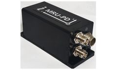
This is due to its integration with a single or dual-antenna GNSS receiver. MRU-BS and MRU-PDS: These models differ from their counterparts in that they are wrapped in a subsea enclosure for fully submerged ocean applications. ...
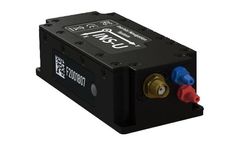
By fusing data from various sources, aided inertial navigation systems can maintain high navigational accuracy even when GNSS signals are weakened or absent, such as in urban canyons or dense foliage environments. ...

The unit is built to withstand the harshest environments and is even ITAR-free, making it a good choice for export applications.One of the most powerful features of the IMU-P Tactical is its ability to be fused with a single or dual-antenna GNSS receiver, allowing the IMU to provide accurate position, velocity, and attitude information even in GPS-denied ...
Satellite constellations use RF signals to transmit information to GNSS receivers. These signals contain information on the satellite ephemeris, clock bias parameters, almanac, and satellite health status. Receivers use these signals to compute position (and timing) information in global coordinates of longitudinal and latitudinal locations. ...
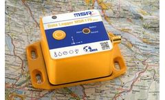
Shock transport logger· 2 acceleration sensors ±15 g and ±200 g· temperature, humidity, air pressure and light sensors · stores 2 million total readings· GPS/GNSS receiver The tamper-proof MSR175plus GPS data logger seamlessly records critical transport events such as shocks, jolts and their geographical position. ...
The newest addition, the AHRS-II-P, is a compact, lightweight, and affordable solution both as a standalone reference unit or a solution where applications involving the integration of an external compass or GNSS receiver may be needed to improve an existing system. Although the AHRS-II-P comes standard with an embedded fluxgate magnetometer to determine accurate ...

The survey area is shown below: Pic 1-1 Maps of the survey area Facility The SL20 Autonomous Survey USV The SL20 Autonomous Survey USV is a new generation of survey vessel integrating navigation system, GNSS Global Positioning System and highly accurate bathymetric surveying system. ...

Measurement setup DATA ACQUISITION SYSTEM • DEWE-43A (8 analog, 8 digital channels, and 2 high-speed CAN bus inputs) • VGPS-HS (100 Hz GNSS receiver with the support of GPS/GLONASS) SENSORS • Entron force transducer with a range of 2500 N • Dewesoft brake pedal trigger SOFTWARE • Dewesoft X with brake test plugin Brake test ...
ByDEWESoft
Data acquisition systems Dewesoft Modules Function KRYPTON 16xTH Temperature KRYPTON 6xSTG Strain gauges and universal conditioning SIRIUSiwe 6xSTG High-speed strain gauges and universal conditioning SIRIUSiwe 8xLV High-speed voltage DEWE-43A Universal conditioning and CAN bus SBOXfe with 10Hz GPS GNSS & Wifi receiver ...
ByDEWESoft