
Groundwater Basin Articles & Analysis
61 articles found
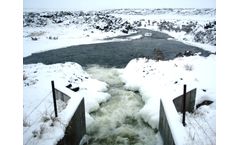
Overview The Idaho Department of Water Resources (IDWR) uses telemetry to view near-real-time water level data and track the response of aquifer recharge basins to changes in flow rates. Hourly groundwater level data provides further insight into barometric efficiency of the aquifer. ...
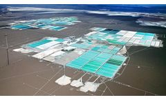
Introduction Many critical mineral resources including lithium, uranium and potash are produced as brine groundwater resources. These critical minerals are typically found in highly saline groundwater in arid closed basins, and beneath dry lake beds. ...
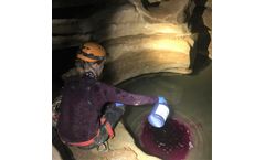
Overview Researchers from Crawford Hydrology Laboratory are conducting dye tracing studies of the Great Onyx Basin in Mammoth Cave National Park, Kentucky, to enhance our understanding of karst hydrogeology and lay the groundwork for future studies on sustainable practices in the park and the role of karst landscapes in the carbon cycle. ...

Client: Dynamic Water Balance Model Location: Monterey, California Solutions: Drinking Water, Wastewater, Water Resources, Water Reuse ...
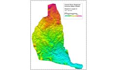
Earthfx Incorporated developed a preliminary regional-scale groundwater model for the entire Grand River Conservation Authority area. The objective of the study was to better understand regional groundwater flow in the GRCA and evaluate the interaction between the river and the various aquifer systems in the basin. ...

PHC release documented during 2003 UST removal operations. In 2009 groundwater contamination extended off-site and under adjacent structures. 2003/2004 concentrations Total Xylenes and Total Volatile Petroleum Hydrocarbons (TVPH) in soils above Colorado RBSLs, Threshold Limit Values (TLV), respectively. 2009 no subsurface soil impacts above RBSLs/TLVs documented. Soils ...

The facilities have the capacity to recharge approximately 250,000 ac-ft [3.1x10³m] of water per year by percolation along the channel of the Santa Ana River and off-channel basins. Groundwater supplies more than 60% of the total water demand in the area and managing this groundwater resource is the OCWD's number one priority. ...

Application Due to increasing water demands, decreasing supplies of imported water, and recurring drought conditions, state and local governments are expanding or developing groundwater replenishment or recharge systems. These systems divert highly treated wastewater, which is typically discharged into the ocean or local surface waters, into natural storage areas. The reclaimed ...

Satellite data is used to minutely track ground levels In California each year, massive groundwater withdrawals for agriculture, industry, and public use lead to aquifer compaction as groundwater becomes depleted. ...
In a recent study, researchers used satellite data to establish a link between excessive pumping from California aquifers and dangerous arsenic concentration spikes in the groundwater of the Tulare Basin. This promises to be an important early warning system for the growing problem of arsenic contamination, which potentially threatens drinking water for more than ...
Los Angeles has been unable to use a massive groundwater basin in the San Fernando Valley due to aerospace industry contamination dating back decades. ...
Los Angeles has been unable to use a massive groundwater basin in the San Fernando Valley due to aerospace industry contamination dating back decades. ...

In the absence of safety measures (as in old landfills) and depending on soil conditions, hazardous substances are flushed by rain into the groundwater. Depending on the type of usage, a number of different hazardous substances can be found, including, among others: Heavy-metal compounds: Copper, lead, chromium, nickel, zinc and arsenic (a metalloid) Organic materials: Phenols, ...

This study analyzes effects of climate change (CCh) and of the increase of impervious surfaces on the groundwater recharge in the Alto Atoyac sub-basin (Oaxaca, southern Mexico). ...
In this research first we developed a hydrological model (SWAT) to estimate recharge rates and its spatiotemporal distribution. Then, groundwater simulation of the basin was simulated and calibrated using MODFLOW 2000 and water quality was simulated and calibrated using MT3DMS. ...
Groundwater is a critical component of the terrestrial water budget and acts as a relatively stable water source in Taiwan. In the present study, river basins' characterization and groundwater storage trends in northern Taiwan are analyzed using the Brutsaert method. ...

To address this uncertainty and confusion, the Center for Energy Water Sustainability (CEWS) at Colorado State University has developed a real-time groundwater monitoring system in the Denver-Julesburg basin, called the Colorado Water Watch (CWW).This real-time system employs the Hydrolab MS5, OTT netDL data logger, and OTT ecoLog 800 groundwater ...
Eğirdir Lake basin was selected as the study area because the lake is the second largest freshwater lake in Turkey and groundwater in the basin is used as drinking water. In the present study, 29 groundwater samples were collected and analyzed for physico-chemical parameters to determine the hydrochemical characteristics, ...
Reliable temporal modelling of groundwater level is significant for efficient water resources management in hydrological basins and for the prevention of possible desertification effects. ...

USGS scientists identified and analyzed large, multi-year, quasi-decadal groundwater recharge events in the northern Utah portion of the Great Basin from 1960 to 2013. ...