

- Home
- Companies
- Lindorm, Inc.
- Articles
Lindorm, Inc. articles
Description: A SediMeter™ instrument and temperature sensors were deployed in Lago Yojoa to measure sediment resuspension during the annual fall mixing event which frequently causes anoxia and fish death. The normally oligotrophic lake is now used for fish farming. Unfortunately theft of hardware by local boaters sabotaged the project repeatedly, and while a stolen cable was replaced by telemetry system made by Lindorm, the SediMeter was lost with data and all.
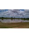
Description: A SediMeter was deployed in this water reservoir in order to collect data on the timing and amount of sedimentation in the water reservoir. Traditional methods include repeat measurements of the bed level, and taking of sediment cores, but they only allow the measurements of the net change between measurements, and are unable to register what exactly happens, and when it happens. In order to optimize the methods for decreasing sedimentation and-the other side of
Description: The northern part of the Caspian Sea has a large input of sediments from the Volga and Ural rivers, and the depth is only around 5 meters in a large area. A harbor development plan in Kazakhstan required the dredging of a 70 km long navigation channel through this area. SediMeter™ instruments were deployed to assess the sedimentary environment, taking advantage of their ability to measure the near-bed turbidity. The SediMeter™ can also be used to dete
Description: In 2007, the Port of Olympia found elevated levels of dioxins in an area scheduled for maintenance dredging. The contaminated sediments have since been dealt with. During this project SediMeters™ were deployed in the area to monitor for near-bed elevated turbidity levels. The SediMeter™ instruments were mounted on steel platforms for sedimentation measurements in the Budd Inlet.
Where: Budd Inlet, Washington State
The Netherlands
Description: Sediment is being removed from a navigation channel and placed in IJmeer to create new land for the city of Amsterdam. Nearby bottoms are protected by a silt screen. Three SediMeter SM4 are deployed outside the silt screen to monitor turbidity and sediment accumulation, and a fourth instrument is used as a reference farther away. See blog article.
Description: Contaminated sediments must be removed and a new basin dredged for a terminal for LNG Canada. Nearby eelgrass beds should be protected from sedimentation caused by sediment spill from the dredging works, especially if those sediments are contaminated. Three SediMeter SM4 are deployed in the nearby eelgrass beds to monitor turbidity and sediment accumulation, and a fourth instrument is used as a reference on the opposite side of the fjord. See
Description: SediMeter™ instruments were deployed in the Ohio River, West Virginia, to measure sediment deposition over mussel beds during maintenance dredging on the river.
Where: Ohio River, West Virginia
Who: USACE
Why: Maintenance dredging threatened mussel banks
What: Monitor sedimentation/siltation from dredging
When: 2009
Mo
The SediMeter™ SM4 has the same sensor as SM3 for beload transport, erosion and sediment accumulation; plus nephelometric turbidimeters for suspended sediment transport; plus an accelerometer for detecting energy levels and for conditions based monitoring (CBM); plus UV anti-fouling; plus a fluorescence meter; plus a
A hundred years ago Physical Geography concerned itself with the description of landforms and processes, and deductions about how these processes had led to those landscapes. Then in the 1930’s a research student in Uppsala called Filip Hjulström crossed the river called Fyrisån every day on his way to the department. He stopped, took a water sample and measured the water level. He then analyzed the sediment con
The SediLink radio modem can be mounted directly on a SediMeter SM3A for lab use. This is useful for instance in a physical model of an engineering project where the objective is to study sediment transport. Later the same equipment can be used to verify the predictions in the field, but with an extension cable between the SediMeter and the radio modem—and a buoy so it gets up above the water surface!