
Refine by
Flood Mapping Articles & Analysis
46 news found

Designed to address Norway's recurring snowmelt- and precipitation-driven flooding, the service will support NVE's efforts to improve hazard mapping, validate forecasting models, and better understand the impacts of major events across the country. ...
ByICEYE
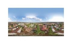
In June, a team from the International Water Management Institute (IWMI) and partner organizations arrived in Dolo Ado, a remote district in Ethiopia’s Somali Region. Their objective was to capture drone imagery and river sensor data to build a digital twin of the region’s hydrological system - a virtual model that simulates water flows, forecasts flood risks and supports emergency ...
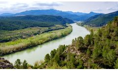
Experts agree that global warming is the main cause of more frequent and intense flooding. According to data published by Oxfam Intermón, the number of disasters caused by floods and droughts in the ten most affected countries has increased dramatically, from 24 in 2013 to 656 in just ten years. In this context, the key to minimizing flood impact lies in proper risk management encompassing ...
ByIdrica
Floods in Kenya have killed at least 228 and displaced some 212,630 people. In East Africa, torrential rain has caused flooding, mudslides, severe damage to vital infrastructure and displaced thousands. ...
Higashihiroshima City, in Hiroshima Prefecture, Japan, recently hosts a flood hazard and disaster prevention related web GIS application developed with the TatukGIS Developer Kernel (DK) for ASP.NET edition that focuses on flood risks posed by hundreds of agricultural irrigation reservoirs. The web mapping application enables anyone in the ...
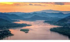
This transboundary lens on data analysis allows communities at one location of the river to better understand water trends occurring at another. Flood & Drought Management The region is known for extreme seasonal variations causing flooding and drought. ...

Visual MODFLOW Flex – Integrated Conceptual & Numerical Groundwater Modeling Software On March 23, 2022 we released Visual MODFLOW Flex 8.0, the latest version of the popular graphical user interface that brings together industry-standard codes for groundwater flow and contaminant transport, essential analysis and calibration tools, and stunning 3D visualization capabilities in a ...

Every year the Bheri River (in Surkhet District, mid-west Nepal) rises to an ‘annual flood level’; every 2-3 years it rises to a ‘periodic flood level’; and on average every 10 years it rises to an ‘extreme flood level’. ...
This prestigious award recognizes the outstanding achievement for work developing storm surge modeling and mapping capabilities in Hispaniola. The award also recognizes a seminal publication in Remote Sensing of Environment entitled “Accuracy assessment of ASTER, SRTM, ALOS, and TDX DEMs for Hispaniola and implications for mapping vulnerability to coastal ...

Those that live in more urban areas, such as cities, typically don’t consider flooding as a problem. Yet one type of flooding can actually affect those in more built-up areas far worse – surface water flooding. ...
Hot off the press is Guerilla Cartography’s Water Atlas, their latest project featuring volunteer submissions of maps on all things water, including one titled “Reducing Water Pollution with a Poop Solution” – a map on SOIL’s EkoLakay household sanitation service! ...
What: Weather and public safety experts will gather to commemorate lives lost, discuss flood safety in Colorado, describe improvements in weather forecasting and compare the two major flood events. Speakers will also discuss how residents and visitors should exercise safety during flash floods. USGS maps depicting the scale of ...
“PRISM uses remote sensing, crop modeling, cloud computing, and smart phone-based surveys for rice mapping and monitoring,” said Alice Laborte, who leads the PRISM project at theInternational Rice Research Institute (IRRI). ...
Hazard and risk mapping are used to categorise hazardous areas of floods (‘zoning’). Maps of this kind are the basis for spatial planning policy to reduce flood risk; almost all European countries have flood hazard and risk maps, as it is required by the European ...
As a result most Europeans can safely drink tap water and swim in thousands of coastal areas, rivers and lakes across the EU. Flood risks have been largely mapped, and plans to manage these risks are progressing. ...
They will also allow comparison between different countries with harmonised datasets. Flood prevention, understanding urban sprawl and mapping ecosystems are just a few uses of the land monitoring data from the Sentinel satellites. ...

The Eems delta is very vulnerable, for several reasons, and a flood in the area would be rapid and deep and severely affect the energy ...
Energy Information Administration (EIA), the Flood Vulnerability Assessment Map, shows which power plants, oil refineries, crude oil rail terminals, and other critical energy infrastructure are in areas vulnerable to coastal and inland flooding. ...
The idea is that with that localized data they can help the public understand the risks they face, especially in coastal areas where flooding is a big issue. The government also is working with several high-tech companies, such as Google, Microsoft and Intel, to come up with tools to make communities more resilient in dealing with weather extremes, such as ...

NIWA is involved in several citizen science projects including measuring snow depths, mapping flooding in Christchurch with the help of photographs sent in by members of the public, and comparing monitoring by communities with professional measurements. ...