

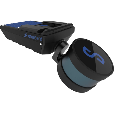
Emesent - Model Hovermap Series -LiDAR Sensing Technology
Emesent’s Hovermap revolutionizes mobile data capture with advanced LiDAR sensing technology. Boasting a sensing range of up to 300 meters and capturing over a million points per second, Hovermap generates high-density, exceptionally detailed point clouds rapidly, accelerating your time to insight. This versatile system supports multiple deployment options such as aerial, handheld, backpack, vehicle, and ground robot-mounted scanning, making it adaptable for previously inaccessible areas. Hovermap's robust IP65 weather-sealed design ensures durability and reliability in harsh conditions. Leveraging Emesent's Wildcat SLAM and autonomy algorithms, it guarantees safety even in hazardous, GPS-denied environments. The device includes autonomy levels like Autonomous Waypoint Mode and Pilot Assist Mode with omnidirectional collision avoidance, providing flexible and secure data capture. The real-time point cloud streaming to the Hovermap app offers a live preview of the captured data, enhancing field operations. The Hovermap ecosystem is further supported by Emesent Commander for mission planning and Emesent Aura for streamlined point cloud processing and visualization, making it a comprehensive solution for technical professionals needing precise and efficient LiDAR mapping.
Hovermap incorporates the latest in LiDAR sensing technology to offer high density point clouds with exceptional coverage. Featuring a sensing range of up to 300 meters and more than a million points per second, Hovermap captures detailed, accurate data over a wide area fast – accelerating your time to insight.
Emesent offers a choice of Hovermap business plans designed to match and support your specific LiDAR mapping and data visualization requirements.
FAST TIME TO INSIGHT
A LiDAR sensing range of up to 300 meters and triple returns capable of more than one million points per second allow you to capture detailed, accurate data over a greater area in less time - increasing efficiency.
SURVEY-GRADE ACCURACY
The award winning Wildcat SLAM solution, Automated Ground Control Points and higher resolution LiDAR sensor provide a cleaner point cloud with sub-centimetre precision allowing you to obtain more accurate measurements and improved insights.
UNIQUELY VERSATILE
The plug and play design and quick-release mechanism allow easy switching between modes. Use Hovermap as a handheld scanner: attached to a drone, vehicle, or pole: lowered in a cage; or mounted to a backpack to easily collect data anywhere. The compact, lightweight design makes it easy to carry and provides longer flight time.
SUPERIOR DETAIL
Capture shadowless, detailed, high quality point clouds of an entire complex asset with high density data sets to reveal richer features. Add a
level of reality capture with Colorization.
DESIGNED FOR TOUGH MISSIONS
All Hovermaps in the ST product range are designed with the tough, lightweight, IP65 weather sealed design giving you the confidence to capture harsher areas. The award winning Wildcat SLAM solution and Emesent autonomy algorithms ensure safety for the drone and asset, even in hazardous, GPS-denied environments.
DEPLOYMENT OPTIONS TO SUIT YOUR NEEDS
Hovermap’s unique versatility allows users to capture data from previously inaccessible areas, either from the air or on the ground. The plug and play design enables easy switching from drone-based use to handheld, backpack, vehicle or ground robot-mounted scanning.
ROBUST, AUTONOMOUS CAPABILITY
Autonomy modes designed to suit your needs with pilot assist with omnidirectional collision avoidance or beyond line of sight Guided Exploration.
LIVE STREAMED POINT CLOUDS
Hovermap streams the live point cloud to the Hovermap app, allowing a real-time preview of the data as it is captured.
DESIGNED FOR FLEET EXPANSION
Accessories are compatible with both Hovermap ST and ST-X, meaning if you expand your Hovermap fleet, you can use the same accessories on different Hovermaps.
AUTOMATED MISSION CONTROL
Emesent Commander makes mapping, pilot assist and autonomous mission planning and control effortless. Designed with user-friendly workflow prompts and built-in fail safes, the Commander app gives you responsive control, ease of navigation and access to Emesent’s market leading autonomous capabilities via a touchscreen interface.
POINT CLOUD PROCESSING
Emesent Aura allows the processing and visualization of scans in one intuitive platform, streamlining the way Hovermap users process, view, and analyze point clouds for faster insights and improved decision-making.