
Refine by
Applications
- Orientation and Navigation Solutions for Aerospace
- Orientation and Navigation Solutions for Industrial Solutions
- Environment Solution for Air Quality Improvement and Management in Key Regions
- Laser based remote sensing instruments for gas detection applications
- Laser based remote sensing instruments for volcanic ash detection applications
- Laser Based Remote Sensing Instruments for Remote Temperature and Humidity Profiling
- Laser based remote sensing instruments for 3D cloud base applications
- Laser based remote sensing instruments for air pollution monitoring applications
- Laser based remote sensing instruments for planetary boundary layer applications
- Laser based remote sensing instruments for remote humidity applications
- Wind Lidar for Offshore construction and operations & maintenance wind monitoring
- Wind Lidar for Site Calibration to IEC 61400-12-1: 2017 Annex C
- Wind Lidar for Wind turbine / wind farm optimisation and due diligence
- Wind Lidar for Offshore platform metocean monitoring
- Environment Solution for Analysis of Atmospheric Pollution Causes
- Environment Solution for Fine Traceability of Atmospheric Particulate Matter Pollution
- Meteorological sensors for aviation weather sector
- Laser based remote sensing instruments for remote visibility / fog applications
- Laser based remote sensing instruments for remote dust monitoring applications
- Laser based remote sensing instruments for wildfire detection applications
- Laser Based Remote Sensing Instruments for Atmospheric Research Industry
- Unmanned Aerial System for Surveying and Spatial Sciences
- Unmanned Aerial System for Engineering Operations
- Unmanned Aerial System for Mining Operations
- Unmanned Aerial System for Commercial Land Development
- Remote Sensing Solutions for Air Quality Monitoring
- Remote Sensing Solutions for Meteorology
- Digital sensor solutions for automotive industry
- Digital sensor solutions for industrial industry
- Digital sensor solutions for smart infrastructure industry
- Smart City Technology for Sensor Technology
- Airborne Sensor Systems for Airborne Surveillance
- Wind Power Solution for Clearance Lidar Ranging
- Meteorology Solution for Refined Meteorological Observation and Forecasting
- Meteorology Solution for Integrated Meteorological Observation and Service Platform
- Meteorology Solution for Meteorological Support for Fire Emergency Rescue
- Meteorology Solution for Early Fire Warning
- Meteorological Sensors for Dust Monitoring
- Borescope Cameras for Tips on Choosing a Sewer Drain Camera
Lidar System Equipment & Supplies
182 equipment items found
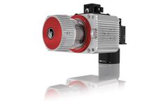
Manufactured by:Phoenix LiDAR Systems based inLos Angeles, CALIFORNIA (USA)
The RANGER-LR LITE is the new lighter Long Range system configuration of our RANGER Series. Designed for the most demanding mapping applications, the RANGER-LR LITE is the ultimate combination of high density, long range LiDAR with a powerful 1,550 nm laser that penetrates dense vegetation at high speeds and altitudes in large scan regions. This ...
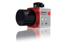
Manufactured by:Phoenix LiDAR Systems based inLos Angeles, CALIFORNIA (USA)
The Phoenix Scout-8 is the newest addition to the SCOUT Series, taking cost-effective LiDAR scanning to new heights with a 60-meter recommended AGL and up to 3 returns. Customize your SCOUT-8 with photogrammetry, hyperspectral, thermal imaging and additional ...
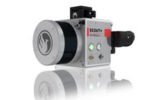
Manufactured by:Phoenix LiDAR Systems based inLos Angeles, CALIFORNIA (USA)
The Phoenix Scout-16 is an excellent entry-level, lightweight system with a 40 meter recommended AGL. A strong fit or smaller scan areas and teams on a budget, the Scout-16 also features options for photogrammetry, hyperspectral, thermal imaging, and more.. Phoenix LiDAR Systems and AP Equipment Financing have partnered to provide you with the ...
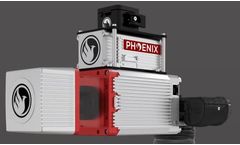
Manufactured by:Phoenix LiDAR Systems based inLos Angeles, CALIFORNIA (USA)
This system features an impressive recommended AGL of up to 75 meters, filling a major AGL gap in the ultra-lightweight UAV LiDAR market. With the photogrammetry package, operators of mid-size multirotors, like the DJI M600 Pro, can now simultaneously acquire survey-grade LiDAR data and high resolution 42 MP RTK photogrammetry at up to 100 m ...

Manufactured by:L3 Harris Technologies, Inc. based inMelbourne, FLORIDA (USA)
Harris' proprietary Geiger-mode LiDAR data collection delivers the most accurate high-resolution elevation data available from an aerial platform for land-use, urban, and emergency planning; civil engineering; transportation and utilities infrastructure management; and natural resource ...
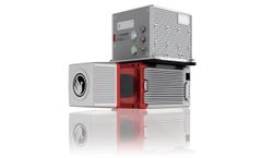
Manufactured by:Phoenix LiDAR Systems based inLos Angeles, CALIFORNIA (USA)
This system features an impressive recommended AGL of up to 75 meters, filling a major AGL gap in the lightweight UAV LiDAR market. With the photogrammetry package, operators of mid-size multirotors, like the DJI M600 Pro, can now simultaneously acquire survey-grade LiDAR data and high resolution 42 MP RTK photogrammetry at up to 100 m operating ...

Manufactured by:WindCube - a Vaisala company based inOrsay, FRANCE
Wind farms are growing larger and more densely filled with turbines, and turbine technology continues to evolve. Vaisala WindCube® Scan Wind Energy Edition reliably and seamlessly provides accurate Wind Resource Assessment (WRA) and wake analysis that are now indispensable to onshore and offshore ...
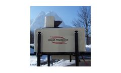
Manufactured by:Metek Meteorologische Messtechnik GmbH based inElmshorn, GERMANY
The pulsed „Stream Line“ Doppler Lidar system manufactured by GB based company Halo Photonics is operated at an eye safe wavelength (1.5 µm, class 1M) and delivers profiles of back scatter intensity from aerosol or clouds, Doppler wind components and derived profiles of horizontal wind speed and wind direction. The system offers ...
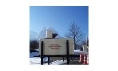
Manufactured by:Metek Meteorologische Messtechnik GmbH based inElmshorn, GERMANY
The pulsed „Stream Line“ Doppler Lidar system manufactured by GB based company Halo Photonics is operated at an eye safe wavelength of 1.5 µm (class 1M) and delivers profiles of back scatter intensity as a measure of aerosol concentration or cloud heights, radial or vertical Doppler wind components and derived profiles of horizontal wind speed ...

Manufactured by:Teledyne Optech Incorporated based inVaughan, ONTARIO (CANADA)
Galaxy is the next generation of airborne solutions, packing more power and accuracy into a tiny footprint than any other sensor. Designed for everything from wide-area mapping to corridor surveys, Galaxy is truly a universal sensor that rivals larger systems with its ultra-dense data and industry-leading measurement precision and accuracy. Galaxy’s new PulseTRAK™ and SwathTRAK™ ...
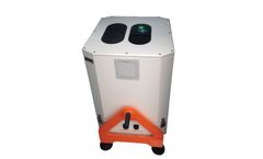
Manufactured by:Cimel Electronique based inParis, FRANCE
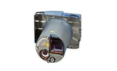
The CE376 is the latest compact, eyesafe backscatter LiDAR, featuring outstanding performances for the automated continuous monitoring of ...
Manufactured by:Teledyne Optech Incorporated based inVaughan, ONTARIO (CANADA)
As the world’s first multispectral airborne lidar sensor, Optech Titan is opening up a new era in lidar survey and mapping. 3D surface spectral response information sensitive to the emitted wavelengths can now be derived day or night from complex environments using a single lidar sensor. Such information opens up exciting new applications and can significantly improve existing ...
Manufactured by:Qingdao Leice Transient Technology Co., Ltd. based inQingdao, CHINA
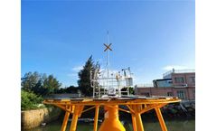
The advanced remote sensing technology has enabled floating Doppler wind lidars to replace the traditional met masts as the trustworthy tool for wind measurement, not only in wind energy industry but also the meteorological ...
Manufactured by:Phoenix LiDAR Systems based inLos Angeles, CALIFORNIA (USA)
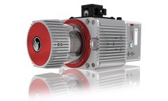
The RANGER LR is the Long Range system configuration of our RANGER Series. Designed for the most demanding mapping applications, the RANGER LR features a powerful 1,350 nm laser that penetrates dense vegetation at high speeds and altitudes in large scan regions. This system is available in UAV, manned aerial, automotive, VTOL and backpack ...
Manufactured by:Microdrones GmbH based inSiegen, GERMANY
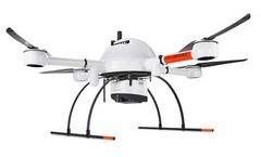
This is the UAV, hardware, software, workflow, training and support that surveying professionals ...
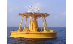
Manufactured by:Qingdao Leice Transient Technology Co., Ltd. based inQingdao, CHINA
The stakeholders and developers are embracing the floating wind lidar systems as wind resource assessment tools for offshore wind farms, which greatly reduced the installation costs compared to fixed met masts in some cases, especially in the deep water ...
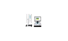
Manufactured by:Everise Technology Ltd. based inBeijing, CHINA
TRL20 LIDAR is the substitute of traditional passive remote sensing temperature LIDAR. It acquires real-time and high-precision aerosol temperature profile. TRL20 is the world-first commercial rotational Raman temperature LIDAR. It's small in size, light in weight, easy to move and could be carried by a car. TRL20 could be adapt to various environmental conditions without any ...

Manufactured by:Bridger Photonics based inBozeman, MONTANA (USA)
Using the fact that each gas absorbs a specific frequency of laser light, pulsed DIAL can determine the concentration of a gas by comparing the returning light from a laser pulse that is absorbed by a gas to a laser pulse that is not absorbed by the ...
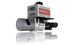
Manufactured by:Phoenix LiDAR Systems based inLos Angeles, CALIFORNIA (USA)
The Alpha AL3-32 is a powerful mid-range LiDAR system, with a recommended max scan height of 65m AGL. Named for its 32 lasers that emit 700k pulses per second, this system accepts up to two returns per pulse, potentially doubling the amount of data captured by a single laser pulse. As a result, the mid-priced AL3-32 produces dense point clouds ...
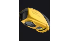
Manufactured by:YellowScan based inSaint-Clément-de-Rivière, FRANCE
The YellowScan Bathymetric LiDAR system is designed for aerial deployment on UAVs, providing in-depth analysis of underwater and land topography through a streamlined, single-button operation. This system employs a class 3B laser scanner developed in-house, optimized for seamless underwater data collection, ideal for topographic continuity in ...