
Show results for
Refine by
Satellite Data Services In Germany
10 services found
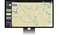
Manufactured by:LiveEO based inBerlin, GERMANY
Leveraging advanced AI to analyze satellite data, LiveEO's Treeline solution delivers timely and actionable intelligence to protect linear infrastructures like electrical grids or rail networks against vegetation-related risks. Our solution ensures safer and more reliable operations by effectively mitigating threats, ultimately enhancing overall efficiency for ...
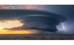
by:nowcast GmbH based inMunich, GERMANY
Use our ultra-precise lightning data as national or private weather service. We guarantee excellent accuracy, quality, availability and easy interface management. As weather service provider you require the best possible weather information. Lightning data from nowcast ideally complement radar and satellite data. Only with ...
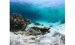
by:EOMAP GMBH & CO. KG based inSeefeld, GERMANY
Our benthic cover and habitat mapping methods are based on our value-added processing chain, which removes the distorting effects of the atmosphere, water surface, and water column from the satellite imagery. This offers you an unbiased and focused view of the seafloor over vast areas, contrary to spotty data collected through diving transects. Together with our ...

by:meteocontrol GmbH based inAugsburg, GERMANY
Precise irradiance data generated from highly accurate Meteosat satellite images – as data series and average values. The foundation for planning and checking PV ...

Manufactured by:NutriSen based inBönen, GERMANY
It offers laboratory-level precision in a field setting, enhancing agricultural efficiency. The approach utilizes satellite data to assess field variability and adapt fertilization strategies accordingly, requiring only three measurements for vast areas. A dedicated app guides farmers on sample collection and communicates results, promoting efficiency and ...
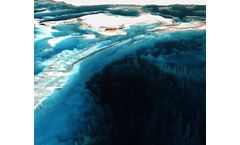
by:EOMAP GMBH & CO. KG based inSeefeld, GERMANY
Satellite-Derived Bathymetry (SDB) offered by EOMAP represents an innovative method for surveying shallow waters by leveraging algorithms developed since the 1990s. This approach utilizes physics-based quantitative solutions to transform satellite sensor data into reliable bathymetric information. Notably, EOMAP is the only provider employing ...
by:Havariekommando based inCuxhaven, GERMANY
This section exists with its assignment of tasks since 1980. It is responsible for all national and international tasks regarding the reconnaissance of and response to marine pollution. We are developing concepts for emergency towing and for all questions concerning places of refuge. The Marine Pollution Response Section (high Sea) represents the Federal Republic of Germany in several ...
by:Geocledian GmbH based inLandshut , GERMANY
ag | knowledge is: satellite based field monitoring, for integration into ICT systems, simple and easy to understand, with global ...

by:enercast GmbH based inKassel, GERMANY
The online service, enercast, generates power forecasts and feed-in projections for he operators of solar power plants and electricity ...

by:GAF AG based inMunich, GERMANY
Since 1985, efficient and reliable EO raster data processes have been the backbone of GAF’s wide range of services in a range of application fields. In the data processing unit, all experts have dedicated image processing and geo-science backgrounds. Over the course of many projects, we have processed vast amounts of data covering all parts ...