
Refine by
Infrared Thermal Imaging Software
2 software items found
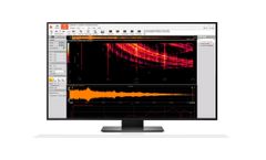
Manufactured by:DEWESoft based inTrbovlje, SLOVENIA
Dewesoft X3 is the most advanced data acquisition, recording and analysis software. The software received multiple international awards, is innovative, easy to use and deep in functionality. ...

Manufactured by:Geoscan based inSt. Petersburg, RUSSIA
Multidimensional spatial data visualization system. Sputnik GIS is a perfect solution for UAV spatial data, processed with Agisoft PhotoScan. View extremely high-detailed 3D models with no limit on data size in the TLS (Agisoft Tiled Model) data format. Open and analyse GeoTIFF and Sputnik KMZ orthomosaics and digital elevation models. Measure length, heights, fill and cut volumes, generate cross ...