
Show results for
Refine by
Locations
- Europe
- Albania
- Andorra
- Austria
- Belarus
- Belgium
- Bosnia & Herzegovina
- Bulgaria
- Croatia
- Cyprus
- Czech Republic
- Denmark
- Estonia
- Faroe Islands
- Finland
- France
- Germany
- Greece
- Hungary
- Iceland
- Ireland
- Italy
- Kosovo
- Latvia
- Liechtenstein
- Lithuania
- Luxembourg
- Macedonia
- Malta
- Moldova
- Monaco
- Montenegro
- Netherlands
- Northern Ireland
- Norway
- Poland
- Portugal
- Romania
- San Marino
- Serbia
- Slovakia
- Slovenia
- Spain
- Sweden
- Switzerland
- Turkey
- Ukraine
- United Kingdom
- Vatican City
Groundwater Data Software In Europe
10 software items found
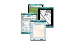
by:ribeka GmbH based inBornheim, GERMANY
GW-Mobil® is a software solution for the acquisition of ground water data in the field, equipped with a set of quality assurance tools. False readings, the confusion of well names or transcription errors, that can happen to the most experienced personnel, are prevented. After the measurements have been carried out, the data is imported from the PDA directly into the ground water management ...
by:Dawaco BV based inCulemborg, NETHERLANDS
Dawaco GW (groundwater) has been considered THE reference for groundwater data management for over 30 years, and is naturally also used by Dawaco BV itself within its full-service services. The management of both quantity and quality data, and the two-way synchronisation with the BRO, make Dawaco GW unique in the Hydrogeological ...
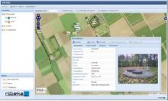
by:ribeka GmbH based inBornheim, GERMANY
GW-Web is a modern web application for publishing water and environmental information from GW-Base® on the internet. Exchange online with partners. Inform a selected number of users. Supply the public with specific information and data. Grant user access to water and environmental data on the internet or intranet , depending on task and specific authorization level. ...
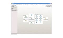
by:ribeka GmbH based inBornheim, GERMANY
Ground water monitoring generally accumulates large amounts of data, which makes it difficult and time consuming to maintain an overview of the qualitative and quantitative development of your ground water resource. GW-Base is a powerful software solution specifically designed to help you handle your ground water data through a highly effective, yet easy-to-use, ...
by:ribeka GmbH based inBornheim, GERMANY
The GW-Arc® 9 Extension seamlessly connects ArcGis® with GW-Base®, which enables a flexible analysis and display of groundwater data. With GW-Arc® 9, you can start GW-Base® directly from ArcGis®, select a single well or an area with multiple wells in ArcGis®, and work on this selection in GW-Base®. New wells positioned in ...
by:ITASCA Software based inMinneapolis, MINNESOTA (USA)
IHOD (Itasca Hydrologic Observation Dataviewer) was developed by Itasca specifically for groundwater data management. IHOD is a customizable QGIS plugin that merges high-level database input/output with tools for viewing hydrogeologic and geochemical data. It interacts directly with underlying databases to retrieve data and ...
Manufactured by:Royal Eijkelkamp based inGiesbeek, NETHERLANDS
Based on your needs, we provide the implementation and functionality for an online environment that enables you to manage your soil and water data. Eijkelkamp Smart Sensoring enables you to effectively and efficiently monitor, visualise and manage quantitative and qualitative data regarding groundwater, surface water, waste water, process water, ...

by:Denxpert based inBudapest, HUNGARY
Monitoring a company’s environmental impact and transferring it into data that is appropriate for the authority is not an easy task. Just think of its many point sources, effluent points, and the multiple pollutants emitted and measured there. Monitoring all of these is a complex task, which must be accomplished at different times, with different frequencies, by collecting data from ...

by:Leeke Associates based inHagley, UNITED KINGDOM
PLog is the most advanced digital system available today for documenting geotechnical and geoenvironmental subsurface investigations. With PLog you easily enter field data on your handheld Personal Digital Assistant (PDA) and then upload the data to gINT on your personal ...
Distributed by:Jakab és Társai Ltd. based inGödöllő, HUNGARY
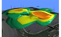
Model data with striking clarity in every dimension. With Voxler’s extensive 3D modeling tools, it is easy to visualize multi-component data for geologic and geophysical models, contamination plumes, LiDAR point cloud, borehole models, or ore body deposit models. Distinguish areas of interest, highlight important information, and easily communicate your newfound knowledge to stakeholders in three ...