
Show results for
Refine by
Locations
- USA
- Alabama
- Alaska
- Arizona
- Arkansas
- California
- Colorado
- Connecticut
- Delaware
- District Of Columbia
- Florida
- Georgia (USA)
- Hawaii
- Idaho
- Illinois
- Indiana
- Iowa
- Kansas
- Kentucky
- Louisiana
- Maine
- Maryland
- Massachusetts
- Michigan
- Minnesota
- Mississippi
- Missouri
- Montana
- Nebraska
- Nevada
- New Hampshire
- New Jersey
- New Mexico
- New York
- North Carolina
- North Dakota
- Ohio
- Oklahoma
- Oregon
- Pennsylvania
- Rhode Island
- South Carolina
- South Dakota
- Tennessee
- Texas
- Utah
- Vermont
- Virginia
- Washington
- West Virginia
- Wisconsin
- Wyoming
Seismic Locating Software In USA
4 software items found
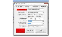
by:W_GeoSoft based inBioley-Orjulaz, SWITZERLAND
With SISM_KML_EDITOR you can display in four mouse click your seismic line location on GOOGLE- EARTH. Data source can be a Station, X, Y, Z text file or a Seismic file (SEG-Y or SU) Sism_KML_Editor can read directly in SEG-Y or SU header! The software is user friendly and can be used very intuitively. ...

by:ITASCA Software based inMinneapolis, MINNESOTA (USA)
IMAT: a mining toolbox for numerical modeling, seismic analysis, and more. IMAT is a cutting-edge geotechnical modeling and seismic analysis toolbox for mining professionals, offering an intuitive interface and powerful numerical tools to streamline complex simulations, optimize designs, perform seismic analysis, and manage risks ...

by:Jaguar Exploration, Inc. based inKaty, TEXAS (USA)
JagSeis® is a web-enabled software application system that sets uniform procedures for seismic consultants (QCs) to consistently and effectively perform and document their activities. The system enables collecting and analyzing QC data and monitoring all phases of a seismic acquisition ...

by:SeismiCat | ImageCat, Inc. based inLong Beach, CALIFORNIA (USA)
SeismiCat provides an on-line seismic risk assessment tool for engineers serving building property owners, lenders, insurers and municipal analysts, consistent with ASTM E2026. The SeismiCat single-site tool uses USGS ground motions (2014 and 2008) computed directly for the relevant Site Class. User can inspect the hazards for the site location, including fault ...