
Canopy Data Articles & Analysis
5 news found
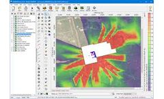
AERSURFACE is a non-regulatory component of the AERMOD air dispersion modeling system. The tool reads digital land cover data and objectively calculates surface characteristics for input to the AERMET meteorological preprocessor. Input to AERSURFACE comes from the USGS National Land Cover Database (NLCD) distributed through the Multi-Resolution Land Cover Consortium (MRLC). Near the end of 2024, ...

Now windPRO users developing wind farms in Latvia have easy access to a comprehensive package with very high-resolution Latvian national geodata. The data is available through the online-data services in windPRO 3.3+ and includes national elevation model (20m resolution) and forest height data (5m resolution, currently with spatial coverage of ...

While digital information systems have fine-tuned growers’ understanding of many aspects of their operations, a simple barrier has long stood in the way of wireless technologies for orchards: the orchard canopy. Wireless networks operate at frequencies of 900 MHz and 2.4 GHz, and both are disrupted by the waves that leaves generate while fluttering in the breeze. ...

In summer, a variety of trees provide canopy coverage of 96.5%. Data were recorded both within and beyond the garden over six hot summer days, three of which saw temperatures exceed 32oC, the threshold above which mortalities have been observed to increase. ...

Following the guidelines of the World Meteorological Organization (WMO), global weather stations collect climate data on open ground — away from trees, said Meine Van Noordwijk, an editor of the book. The collected data are then used for climate modelling and projections. But trees can affect the local climate in a region, for example by reducing the ...